Good news for Florida: the drought continues to improve across the state, and there is no longer a single area experiencing the highest level of drought, known as Exceptional Drought (D4). We can thank the remnants of Tropical Storm Arthur partly for this.
From north to south, the Florida Panhandle—the only region with about 4% of its area classified as Exceptional Drought—has completely eliminated that category. While parts of the Panhandle, especially the central Panhandle and portions of North Florida, continue to experience Extreme Drought (D3), this remains the area with the greatest drought coverage in the state. Even so, Extreme Drought has improved by about 4%. Severe Drought (D2) has improved by approximately 7%, while Moderate Drought (D1) has seen the greatest improvement, shrinking by about 16% statewide.
This week's U.S. Drought Monitor also shows a larger portion of Florida now classified as having no drought, particularly across western Florida and along the Space Coast. This is excellent news for Florida, which has experienced one of its most significant droughts in recent history. Not only did the state endure an exceptionally dry season this year, but drought conditions had already begun developing during last year's rainy season across parts of Florida.
Location | June's observed rainfall in inches | June's average rainfall in inches |
MIAMI | 1.59 | 8.48 |
FORT LAUDERDALE | 1.00 | 7.86 |
WEST PALM BEACH | 4.04 | 6.92 |
KEY WEST | 5.86 | 3.44 |
FORT MYERS | 3.62 | 7.52 |
TAMPA | 0.62 | 5.63 |
ORLANDO | 0.91 | 6.48 |
MELBOURNE | 6.85 | 5.69 |
GAINESVILLE | 2.99 | 6.00 |
JACKSONVILLE | 4.14 | 6.03 |
TALLAHASSEE | 5.11 | 6.21 |
PENSACOLA | 5.18 | 5.84 |
Keep in mind that while these improvements look encouraging on paper, some regions—especially the metropolitan areas of Southeast Florida—remain below average in rainfall for the month of June. Much of South Florida has been dominated by sea breezes that have pushed the heaviest rainfall toward the Everglades and Southwest Florida. Although those areas experienced the worst drought for the longest period, this weather pattern has left the more populated communities along eastern Palm Beach, Broward, and Miami-Dade counties well below their average June rainfall.


We still recommend using caution with anything that could spark a wildfire. Although drought conditions have improved, there is still plenty of extremely dry vegetation that can easily fuel fires.
Looking ahead to the weekend, a high-pressure system in the middle and upper levels of the atmosphere will limit shower and thunderstorm development. At the surface, winds will primarily come from the south-southwest, increasing temperatures and humidity, especially across the interior and along Florida's east coast. As a result, heat indices are expected to climb, making it feel even hotter despite the limited rain chances.


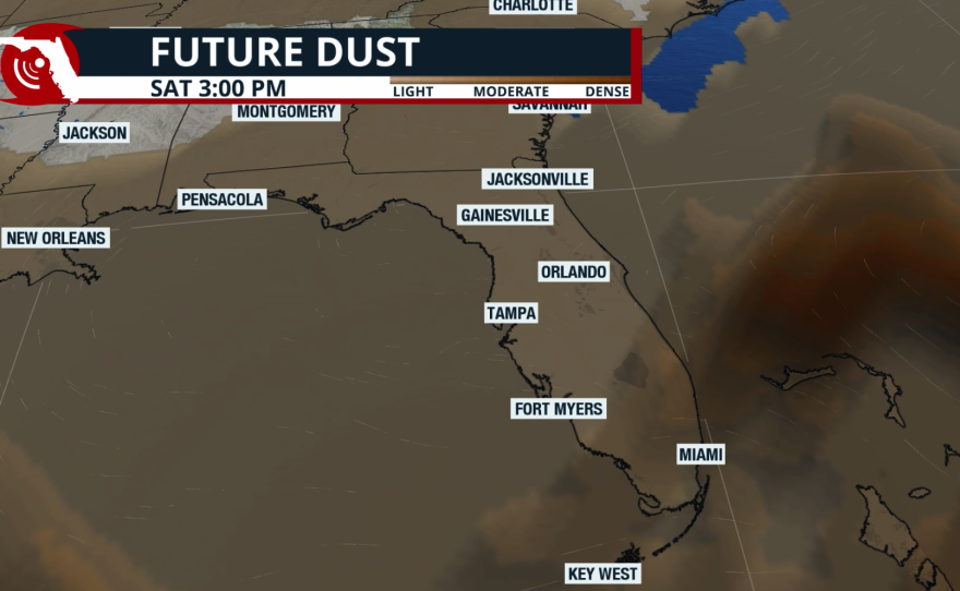
Although there will be fewer areas of storm activity overall, the sunshine might not be full. South Florida and Central Florida could have hazy skies at times due to a layer of Saharan dust arriving over the weekend. This will make the temperatures feel hot, too! This layer will not be too thick, but it could be thick enough to prevent the skies from being completely blue. If you suffer from respiratory issues, make sure you limit your time outdoors, as these dust particles can make breathing difficult.