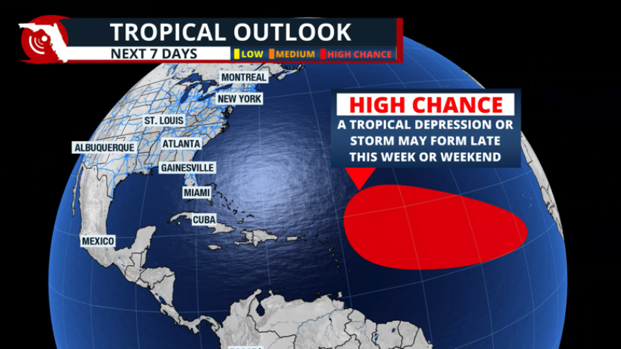
Most of the tropics remain quiet during the early part of September. There is a tropical wave that is moving away from the Cabo Verde islands, and it’s expected to continue to travel westward and enter an area where tropical formation could happen during the next seven days.
The tropical disturbance remains very disorganized, but it is moving over the central Atlantic. It could gain better organization and become the next named tropical system of the season. This system could be named as early as late this week or during the weekend. Currently, the National Hurricane Center gives it a 70% chance for tropical development during the next week or so. The next name on the list is Gabrielle.
Where could it go?
As we have previously discussed, it is impossible to know exactly where a system that has not yet developed will end up. However, one feature that this system is hinting at is that it is likely to gain strength as it remains over the central Atlantic, away from the Caribbean. If the tropical disturbance develops in the central Atlantic, there are higher chances that this system will also turn north, likely missing the Caribbean.
Hurricane Katrina 20th Anniversary: Advancements in Intensity Forecasting (Part 4 of 5)
— National Hurricane Center (@NHC_Atlantic) August 28, 2025
Friday, August 29 is the 20th anniversary of Hurricane Katrina making landfall along the U.S. Gulf coast and devastating the coasts of Mississippi and southeastern Louisiana. A lot has… pic.twitter.com/JPFehcGglq
The movement is mainly due west this week and into the weekend, due to the Bermuda high, which keeps the system on this route. The Bermuda high is expected to move east closer to the Azores. This shift would allow the system to turn north, just as Hurricane Erin did a few weeks ago.
Again, it is way too early to know precisely when and if this turn will occur, but long-term models are hinting at a north turn. Residents in the northeastern Caribbean, as well as visitors, should closely monitor this system. It is currently impossible to determine how close this system could approach another part of the Lesser Antilles.
Why are the tropics so quiet?
Although it may seem unusual to have no systems in place during the days leading up to the peak of hurricane season, it is not unprecedented. The 2025 hurricane season is actually near-average in terms of the dates of tropical formation. There have been six named systems in the Atlantic. The average date for the seventh named storm is September 3. We are ahead of season as far as major hurricanes; the first major hurricane on average forms by September 1. Hurricane Erin was the only major hurricane to develop this season, emerging during the second half of August.
Recent memories of hyperactive seasons could lead us to think that the season is quiet. Still, we are near average, with a high possibility of more tropical waves emerging from Africa and half of the hurricane season ahead of us.
Why not more storms?
A significant amount of dry air has been present across the Caribbean, along with Saharan dust, which has hindered storm activity in the region. Additionally, the Bermuda high has enabled the systems that have developed to turn northward, as the high-pressure system has been shifting east, closer to Europe.
Don’t let this put your guard down, as we still have the second half of hurricane season, and these upcoming weeks tend to be the busiest. Tropical waves are emerging from Africa in the coming weeks, and we will be monitoring these closely and continue to bring you updates.

