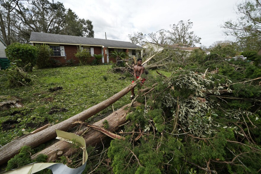
The Florida Panhandle continues to feel the impacts of what’s now the remnants of Hurricane Ida, through rain bands moving through the region.
Ida will go down as the fifth-strongest storm to hit the United States based on wind speed —about 150 mile an hour at landfall west of New Orleans. In his weekly news conference, Mayor Grover Robinson said Northwest Florida can expect 8 to 12 inches of rain over the next couple of days, compliments of Ida.
“High rip current risk through Wednesday night; high surf warning until 7 a.m. Tuesday morning,” the mayor said. “These are all some of the things that are occurring at this time with Hurricane Ida.”
For now, city crews are out monitoring and checking for any damage.
“Essentially sort of an emergency necessary personnel are here today at the city,” said Robinson. “Our non-essential personnel are still at home at this point allowed to tele-work. That will be just today; we will all be back here, business as usual, on Tuesday.”
For many city departments, the mayor says it was just a typical Monday.
“We are picking up garbage today, and your normal pickup will continue your normal days,” the mayor said. “We continue to monitor all of our intersections, our roads. At this particular time the only roads I know we’ve had problems — our usual issues where there’s low elevations — 9th Avenue and South Devillers Street l — we continue to experience problems. But we should be able to work through all of those.”
“Overall we’ve fared well; we’ve only taken one minor call of damage and that was a tree down that just ended up being a limb in the road. So overall we’re doing pretty well,” said Brad Baker, Santa Rosa County’s Public Safety Director.
And what about the next couple of days?
“I think about the same; we might get some additional rain; so far [with] these pauses, our roadways are able to handle it,” Baker said. “We’ve got no road closures or anything, and we’ll just kind of see how much is dumped in the different river basins and watch for some river flooding in a couple of days.”
While Ida’s fury was unleashed on New Orleans and much of the rest of Louisiana, Baker’s hoping residents here will take note, and revise their hurricane plan if needed.
“Just take some time to review your plans, and of course watch the news and see all the damage,” Baker said. “Damage occurred in Louisiana and along the Mississippi coast, so just be prepared and ready to go if the next one puts its eye on us.”
“We had a couple of road conditions — 97 and Highway 29 — went underwater for a little bit in the southbound lanes; but we had the rain bands come in and give us a heavy deluge, and give us a little bit of a reprieve, and let it drain out,” said Escambia County Public Safety Chief Eric Gilmore. He adds that there was some localized flooding, which was expected -- but most were more-or-less short-lived.
“We did have several issues out there at Innerarity Point; North Shore and Red Cedar — it stayed underwater for longer than we anticipated due to some tidal push,” Gilmore said. “And we did see some coastal erosion; the surf and the wave heights were pretty good. We saw a couple of tornado warnings; thank goodness none of them touched down and we didn’t have any damage from them.”
Something that did not happen was the full activation of Escambia’s Emergency Operations Center. Gilmore says staff was there monitoring Ida, but the need didn’t go any further than that.
“There’s no sense in bringing partners in to just to stare at each other and twiddle thumbs; we try not to waste anybody’s time and only use them when we need to use them,” said Gilmore. “So EM was monitoring and then the EOC throughout the weekend. So while we weren’t at a full activation, we did have emergency services up-staffed; extra fire personnel on, and extra EMS to make sure that we can meet the need of the public.”
Some more numbers generated by Ida: it’s the latest of 17 storms hitting the U.S. over the past two years; the sixth storm to hit in 2021, and it's the first time in 150 years that a state has been hit by two hurricanes with 150 mph winds in consecutive years. Ida is also one of the most rapidly-intensifying storm in hurricane history.

