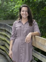
Florida researchers have received $1.5 million from the Gulf Research Program of the National Academies of Sciences, Engineering, and Medicine to map climate change health burdens.
Florida State University is partnering with Colorado University Boulder and Tulane University to identify climate change and health disparities along the Gulf Coast.
They're looking at Florida, Louisiana, and Texas for evidence of how extreme heat, air pollution and tropical cyclones or hurricanes are adversely impacting health.
"We have a general sense that all those three exposures are bad for you,” said project director Christopher Uejio of FSU.

“But how do they interact? Are there specific places that have been suffering disproportionately, historically? And have there been any improvements to those over time? That's the types of things this project hopes to answer."
Climate change is adversely impacting human health in multiple ways, Uejio said.
There’s the record-breaking heat this past summer, rapid intensification of tropical cyclones and hurricanes, and an increase in aeroallergens during the pollen season.
“Your grasses are just growing longer in the fall, and things are budding out earlier in the spring. And that is leading to more common respiratory problems,” Uejio said.
“While we can’t link some emerging infectious diseases, like the transmission of dengue, specifically to climate change, we certainly know that these systems are incredibly sensitive to changes in temperature and moisture. So, there's a continuum of evidence and risks, but it's clear that climate variability is impacting human health adversely and through that change.”
Those most at risk are children, older adults, people with preexisting conditions, outdoor workers, recreational athletes, and lower income people.
He said there are so many federal programs and grants available to communities in need through the Federal Emergency Management Agency, the Department of Housing and Urban Development, and the more recent Inflation Reduction Act.
“There are federal initiatives such as Justice40, which is an executive order. [It] directs 40% of the benefits of federal spending programs towards the places, the neighborhoods that essentially have disparate health outcomes or exposure. So, while that can be defined in different ways, our goal is … to further strengthen the evidence about how disparate are these certain neighborhoods,” Uejio said.
He said he hopes their study connects people to solutions.
"Communities just need to make the case and perhaps integrate these hazards into their existing plans, whether that's a comprehensive emergency management plan or hazard mitigation plan, but that opens up then a wider stream of funding for them to build longer term results," Uejio said.
The scientists will break down the information by ZIP code using census data from the past 40 years.
“We're trying to get at what we might call in public health a ‘life course.’ But essentially, what are your risks from birth to death? So we don't have perfect records of all those, but we have pretty good birth records and death records. And then hospitalization emergency department visit records,” Uejio said.
Uejio said they will also be looking forward in time to “reasonable period.”
“Forecasting the future is certainly a difficult endeavor, but we can take some of our best get educated guesses to looking at something like what how things may or may not change by the year 2050,” Uejio said.
The researchers plan to log the health disparities within a couple years and then have preliminary projections for the future, a year or so after that, so Uejio said the mapping could be done in 3-4 years.
Copyright 2023 WUSF 89.7. To see more, visit WUSF 89.7. 9(MDAxODMzNjEzMDEyMTY4MzMwNzBiMGMyYQ004))


