

The cold front will enter North Florida on Saturday morning. Ahead of it, a few clouds will push through Central Florida, but cloud cover will linger across North and Central Florida through the afternoon and into Saturday evening. As the cold front pushes south, a low-pressure system will develop just east of the Space Coast, allowing more instability to move into South Florida.
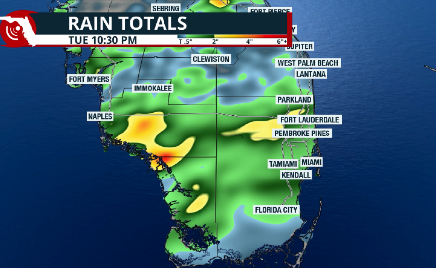
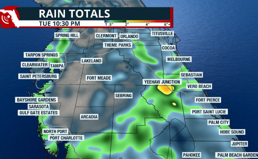
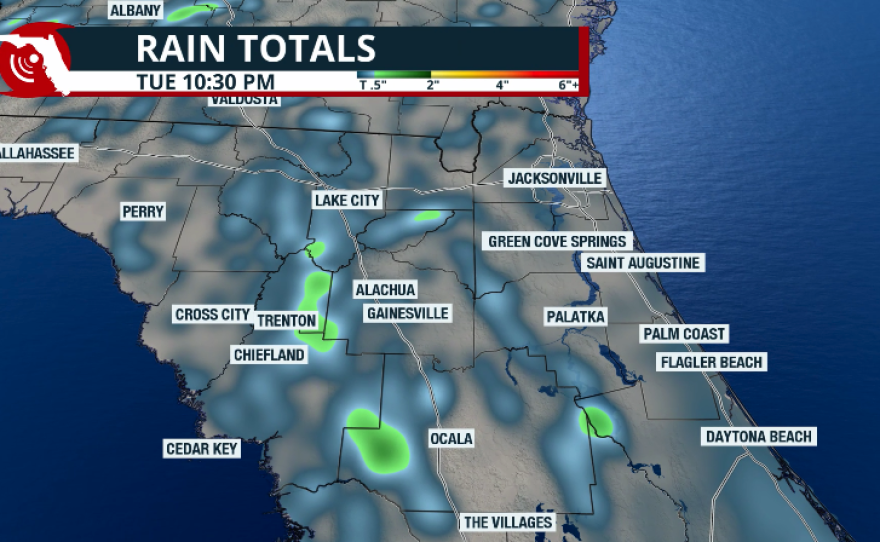
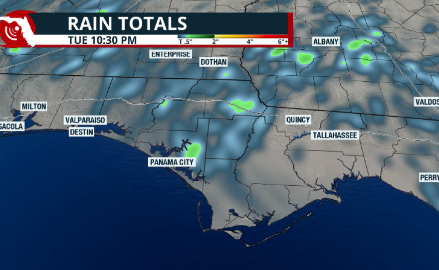
Rain chances in South Florida will increase starting Saturday night into Sunday. There is a risk for some isolated storms throughout the day on Sunday. We’re not expecting a washout for South Florida, but some areas could receive between 1 and 2 inches of rain. This is much-needed rainfall for the region, though more rain is still needed across the rest of Florida. We do not expect much rain over Central or North Florida this weekend—only a few isolated spots may receive around a quarter of an inch.
This cold front will not bring a drastic change in temperatures, but it will increase the winds across Florida. Gusts, even in some areas across inland Central Florida, could reach 45mph. pic.twitter.com/kKuH7A9d1R
— Florida Public Radio Emergency Network (FPREN) (@FloridaStorms) March 28, 2026
Windy Weekend
The big story this weekend will be the strong winds impacting Florida.
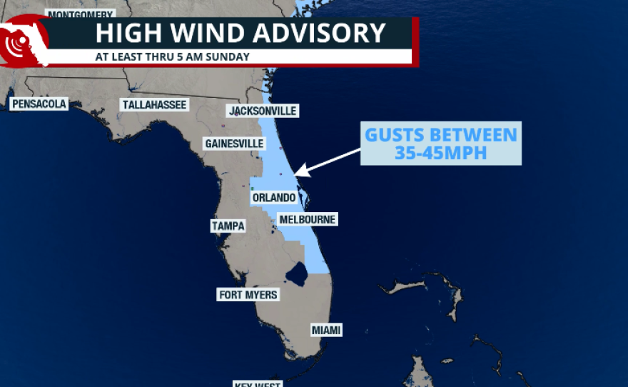
Along the coast, a Gale Warning will be in effect, meaning very strong winds and hazardous seas. Nearshore seas could reach up to 15 feet across East-Central Florida into Northeast Florida. A Small Craft Advisory will also be in effect along much of Florida’s east coast. It's going to be a windy weekend across many parts of Florida. A high wind advisory is in effect for the eastern Central Florida region until Sunday morning. Here is where the winds will be the strongest, with gusts between 35 and 45 mph. The rest of the state will also be windy, but the gusts will likely remain just below the advisory threshold. Nonetheless, please keep in mind that new advisories may be issued if winds are expected to reach the limit.
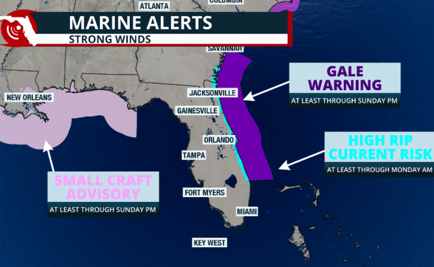
As the cold front pushes through, winds will remain out of the east along the East Coast. This will increase the risk of rip currents along the entire Atlantic coastline of the Sunshine State. If you’re planning to head to the beach, make sure to stay near a lifeguard. Even as seas begin to diminish, the risk of rip currents is likely to remain elevated through early next week.
Will Temperatures Drop?
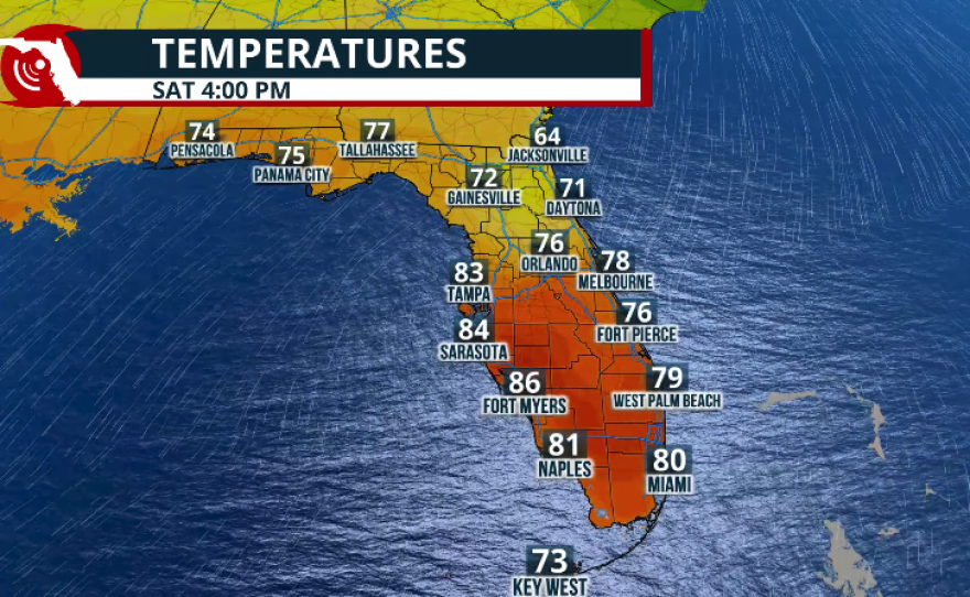
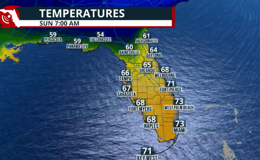
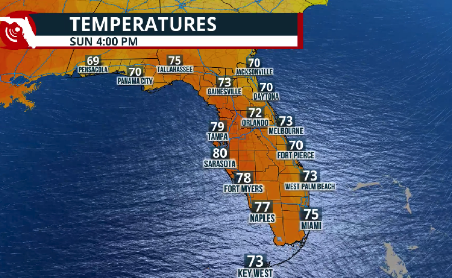
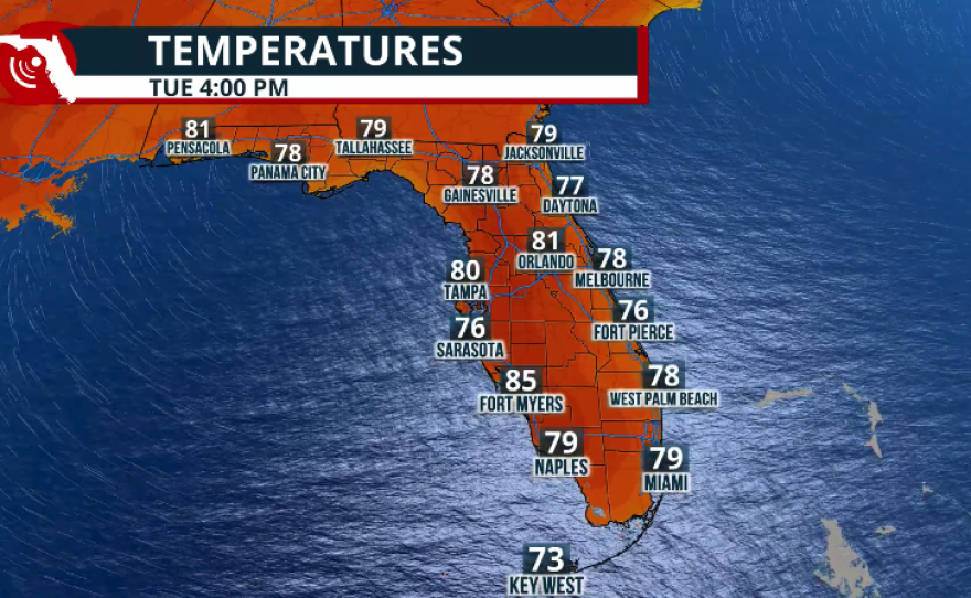
This cold front will not bring a drastic change in temperatures, with readings remaining near or slightly above average for this time of year. On Sunday, temperatures will be between 2 and 5 degrees below average in the afternoon, mainly due to cloud cover, rain, and strong winds.
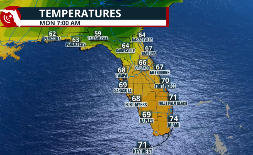
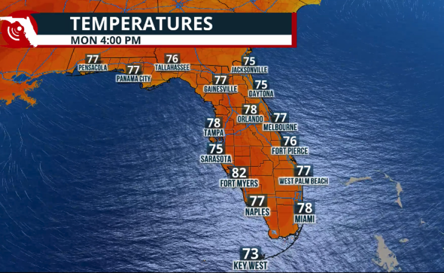
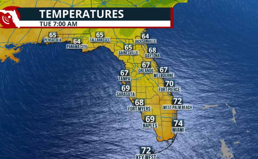
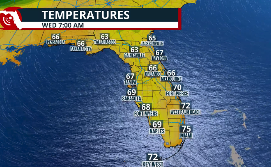
By Monday, clouds are expected to linger, especially across South Florida, helping keep afternoon temperatures below 80 degrees. Similar conditions are expected on Tuesday, with temperatures increasing across the Panhandle and staying slightly above average in the low 80s. Morning temperatures are not expected to drop significantly, and conditions will remain rather muggy as easterly winds continue to bring in moisture. Lows on Sunday morning will be around the low 50s along the I-10 corridor, mid-60s in Central Florida, and upper 60s to low 70s in South Florida.
FLORIDA'S DROUGHT UPDATE

Fire Danger Across the Panhandle
We remain deep in the dry season, and with drought conditions expanding across the Panhandle and little rain expected this weekend, fire danger will remain elevated. A Red Flag Warning is in effect for the Panhandle through at least the end of the day Saturday. Humidity levels will drop once the cold front moves through, and winds will be out of the northeast at 25 to 30 mph. Avoid any activities that could create sparks or start fires. Under these conditions, fires can start easily, spread quickly, and become erratic.
Mar 27 | Heads up for this weekend! Windy & dangerous surf/boating conditions develop behind a passing front. #flwx
— NWS Melbourne (@NWSMelbourne) March 27, 2026
💨N/NE winds 20-30 mph, w/gusts of 35-45 mph Sat/Sat night
🌊High surf of 7-12 ft & High Risk of Rip Currents
⛵️Gale conditions leading to dangerous boating pic.twitter.com/0JjPdZwoF4
When could there be some drought relief? 🤔
— NWS Tampa Bay (@NWSTampaBay) March 27, 2026
Probably not until the summer 🙃👎
During this extremely dry period, make sure you are doing you part to conserve water 💧
Follow local watering rules ✅
Check for plumbing leaks ✅
Be mindful of your daily use ✅#flwx pic.twitter.com/NX7KA4152v