

Florida will see a pair of cold fronts pushing through the state. The first one will fizzle as it moves over the Treasure Coast, but it will continue to bring rounds of showers and isolated storms throughout the weekend. The second cold front seems likely to fizzle as it approaches the state, with little impact on temperatures or rainfall.
A cold front will continue to push across Florida on Friday night. There has been plenty of rain and even isolated thunderstorms moving through the Panhandle and North Florida on Friday. The showers and downpours have affected the other half of the state and will continue to impact this region, including Central Florida, on Saturday morning. It is a slow-moving cold front, and this slow movement will actually weaken it. Nonetheless, there is plenty of moisture across the peninsula and even inland, which will continue to bring rounds of showers and isolated thunderstorms throughout parts of the I-4 corridor, from Tampa through Orlando and along the Space Coast.
There will be a front trying to push through Florida this weekend, but don't expect a drop in temperatures. It will bring rain, not enough, but still rain!
— Florida Public Radio Emergency Network (FPREN) (@FloridaStorms) February 28, 2026
Another front will drop humidity values across the northern half of Florida to start next week. Still no cold! pic.twitter.com/v2tPngxda9
As the front becomes stationary, Saturday morning will be marked by numerous showers across Central Florida, into parts of Southwest Florida, and along the Treasure Coast. Clouds will try to push farther south, reaching South Florida, but most of the precipitation will remain focused across Palm Beach County, with only very isolated showers reaching Broward County. Meanwhile, Miami-Dade should remain mostly dry on Saturday.
Instability will reach South Florida on Sunday. There could be showers and an isolated thunderstorm moving through the region from late morning into the early afternoon. Overall, weather conditions will become more stable again during the evening hours. Humidity levels will stay high across the southern half of the peninsula, as winds on Sunday will remain mainly out of the east. A bit more dry air may filter in during the evening hours, but the overall weather pattern will remain under an easterly flow, which will keep humidity levels elevated, especially across the southern half of the peninsula.
VISIBILITY REDUCED.
— Florida Public Radio Emergency Network (FPREN) (@FloridaStorms) February 28, 2026
Overnight, dense fog will develop over northeast and North Florida. Visibility could drop to less than 1/2 mile.
Reduce your speed, and use low beam. pic.twitter.com/kXZVs1mBy7
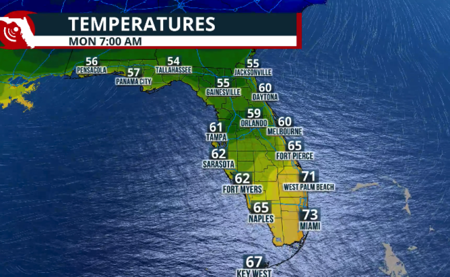
A second front will try to sweep across Florida at the beginning of the week, but it appears this front will also lose its punch as it travels south.
Overall, rainfall over the weekend will not be too impressive. There could be up to half an inch of accumulation across parts of Central Florida, with some isolated spots getting closer to three-quarters of an inch. Across South Florida, depending on where isolated storms set up and linger, some areas could receive between 1 and 1.5 inches of rain. However, these higher totals will be very isolated.

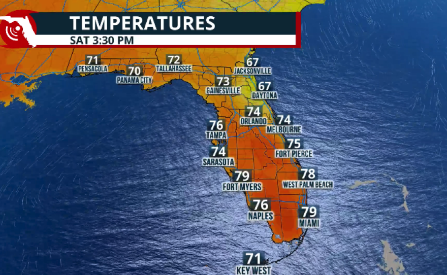
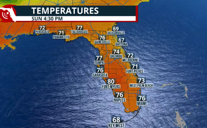
As for temperatures, expect them to remain slightly above normal for this time of year. Overall, conditions will stay muggy across South Florida, with afternoon temperatures running 3 to 5 degrees above average. Humidity will remain elevated, especially across the southern half of the peninsula, with overnight lows in the upper 60s to low 70s. A warming trend is expected next week as high pressure builds in, allowing temperatures to increase further.


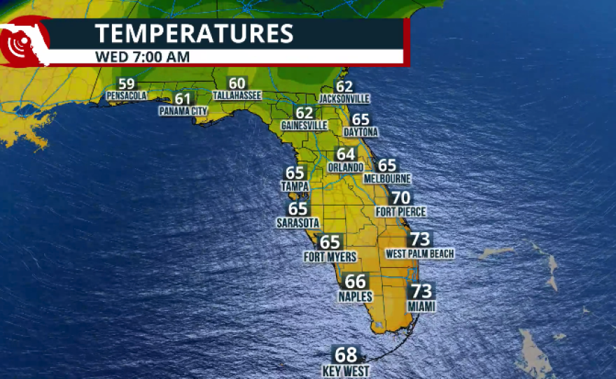
We are starting March on a warm note. By the middle of the week, most of the peninsula will see afternoon temperatures in the low to mid-80s, along with plenty of humidity.