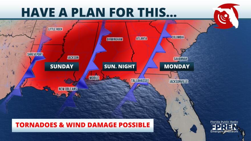
Tornadoes, damaging straight-line winds, and large hail are possible across the Florida Panhandle Sunday Night, thanks to a powerful storm system sweeping across the Southeast. Strong storms are also possible across portions of north and northeast Florida Monday.
The ingredients for a severe weather outbreak will come together over the weekend across the Mid-South. A strong cold front is expected to track from the Southern Plains into the Lower Mississippi Valley Sunday, then crash into a humid and unstable airmass moving northward from the Gulf of Mexico. At the same time, strong westerly winds in the upper levels of the atmosphere will create an environment favorable for the development of numerous rotating thunderstorms.
The greatest risk of a tornado in the Florida Panhandle is after sunset, making the situation particularly dangerous. Floridians from Pensacola to Florida’s Big Bend are strongly encouraged to be stay informed of the risk throughout the weekend. The storms are then likely to enter the northern third of Florida’s peninsula Monday. At this point, environmental conditions may be less supportive of tornadoes, but damaging wind gusts will remain a valid concern for cities such as Lake City, Gainesville and Jacksonville.
National Weather Service and emergency management personnel are urging residents to have several ways to receive warnings. This will increase your ability to act suddenly in an effort that might save you or your family’s life. Alerts are available via the Florida Storms app, a NOAA Weather Radio, and the stations of the Florida Public Radio Emergency Network. Live streaming will also be available on the Florida Storms Facebook Page when dangerous storms develop.
Copyright 2021 WUFT 89.1. To see more, visit WUFT 89.1. 9(MDAxODMzNjEzMDEyMTY4MzMwNzBiMGMyYQ004))

