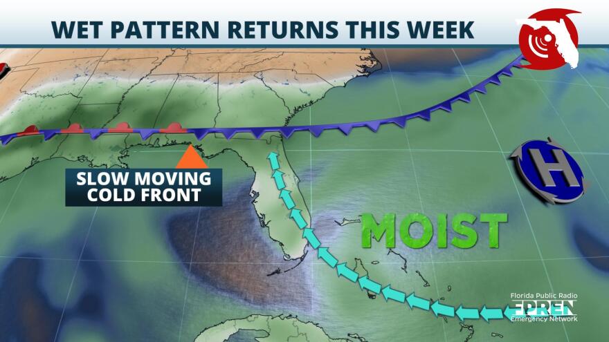
A slow moving cold front is expected to bring an increased chance of showers and thunderstorms to parts of the Florida Panhandle and North Florida beginning Monday.
A deepening low pressure system over the Ohio River Valley was moving eastward Sunday towards the Mid-Atlantic states dragging a cold front to the southwest. Scattered showers and thunderstorms ahead of the front were marching east across the Gulf coast during the afternoon hours on Mother’s Day. This same cold front is expected to take aim at the Sunshine State for the new work week.
Ahead of the cold front lies an ample amount of atmospheric moisture which will continue to increase thanks to a high pressure system situated off the east coast of Florida. The clock-wise winds around the high pressure system will contribute to a southerly flow being introduced to the Sunshine State. This southerly flow will aid in increasing moisture values as well as temperatures and humidity.
The cold front is anticipated to approach and sag southeastward into parts of the Florida Panhandle Monday afternoon and become nearly stationary over North Florida through midweek. Rain chances are expected to remain elevated through at least Thursday before the cold front finally moves slowly southwards towards parts of Central and South Florida.

A Marginal Risk (hazard level 1 out of 5) is in place for most of the Florida Panhandle and the Big Bend region beginning Monday and lasting into Tuesday. Isolated severe thunderstorms are possible with localized damaging wind gusts and hail up to quarter size. The marginal threat will move east to include parts of the northern Peninsula Tuesday.
The severe threat at this time is expected to be minimal but a few storms could reach severe levels each afternoon. The main concern will be isolated flash flooding for areas that pick up continuous rainfall. Multi-day rainfall totals of 1 to 2 inches are forecast this week with maximum rainfall amounts up to 4 to 5 inches possible which could lead to some flooding concerns.
Scattered afternoon showers and thunderstorms will be possible each day this week for Central and South Florida but will increase into Wednesday and Thursday as the cold front pushes southward. Drier conditions expected by the end of the work week across the majority of the Sunshine State as high pressure builds in from the northwest.
Copyright 2021 WUFT 89.1. To see more, visit WUFT 89.1. 9(MDAxODMzNjEzMDEyMTY4MzMwNzBiMGMyYQ004))

