While Tropical Storm Gordon has come and gone, it’s leaving behind a soggy legacy in northwest Florida and south Alabama for the next few days. WUWF’s Dave Dunwoody reports.
Gordon and his 70 mile an hour winds — just shy of hurricane strength — made landfall near Pascagoula, Mississippi late Tuesday.
“Most areas over there in the western Florida Panhandle from Pensacola eastward have received 5-8 inches just since the start [Tuesday] evening, and it’s still raining,” says Jack Cullen, a forecaster at the National Weather Service in Mobile.
“Another couple of inches is not out of the realm of possibility,” said Cullen. “We’ve seen that tropical rainfall can put down a lot of rain in a short period of time.”
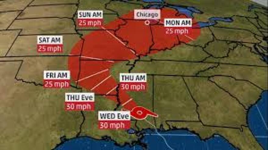
As of midday, the remnants of Gordon — now a tropical depression — are located in southwestern Mississippi approaching Arkansas. Winds are down to about 30 miles an hour and movement is northwest at 14 miles an hour. And Gordon did leave behind a calling card.
“We’ve got this one [rain] band that’s setting up from roughly Pensacola over to Fort Walton Beach and northward up through south-central Alabama. It continues to ‘train’ and move over the same areas,” Cullen said.
More than 27,000 households were without power as Gordon began moving ashore, mostly in coastal Alabama and the western Florida Panhandle, and a few hundred in southeastern Mississippi. Gulf Power reports restoring power to 13,000 customers, most of them in Escambia and Santa Rosa Counties – with the work continuing.
Gordon, says Cullen, was a good, stout tropical storm with at least one hurricane-sized wind gust — 74 miles an hour at Dauphin Island.
“The widespread wind gusts for [Gordon] were a little bit higher than what we experienced last year with [Hurricane] Nate, just because this system was still strengthening as it was coming in,” said Cullen. “The main threat with the system – as it was and continues to be is the heavy rainfall.”
Most roads in the area are open, with the exception of County Road 399 – J. Earle Bowden Parkway between Pensacola Beach and Navarre Beach. Travelers are urged to use extreme caution, especially around standing water.
“Slow down, the roadways are going to be wet; just make sure that you’re not going to cross any standing water because flowing water across a roadway the roadway could be washed out,” says Lt. Eddie Elmore with the Florida Highway Patrol. He adds that if you come up to an intersection where there’s a power outage and no traffic lights, treat them as a four-way stop.

“Never enter an intersection with the lights inoperative unless you’ve stopped and are aware of what’s coming into the intersection,” Elmore said. “Just make sure you stay in between lanes; you’re controlling your vehicle and attentive of the environment around you.”
The rain from Tropical Storm Gordon is expected to taper off later today, and the National Weather Service’s Jack Cullen says things will begin to get back to normal, with more typical afternoon shower and thunderstorm pattern by the weekend.
“As we’ve seen in the past, Pensacola’s experienced numerous tropical systems over the course of the last ten years,” says Cullen. “These systems drag so much moisture northward with them, that you get an enhancement of the showers and thunderstorms, even a day or two after the system moves inland.”
Tropical Storm Gordon never became a hurricane but it was deadly just the same. A downed tree hit a mobile home in Pensacola, killing an infant inside. There were reports of a pair of small tornadoes in Santa Rosa and Escambia Counties on Tuesday night, but Cullen says at this point, neither were confirmed and there have been no damage reports from them.

